The sections below contain information on the LST data types; including output attributes, quality and purpose of the data. Click on the pictures for links to the data.
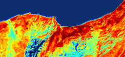
LST is an important parameter for assessing the physics of land surface processes (local and global), such as the surface energy balance between atmosphere and ground. It is widely used in a variety of fields including climate change, vegetation monitoring, urban climate and environmental studies. LST is difficult to estimate and validate due to the strong heterogeneity of land surface characteristics such as vegetation and soil, causing it to rapidly change in space as well as in time. Satellite data offers the best option for measuring LST over the entire globe with sufficiently high temporal resolution. See the below links for LST data.
AATSR LST Team
Format: L1b/L2 Envisat N1, ERS and NetCDF format
Quality: Various
Digital Object Identify (DOI) number: N/A
Date of most recent version:
Access: The ESA service is available to users worldwide via a registration process on their website.